Dive Brief:
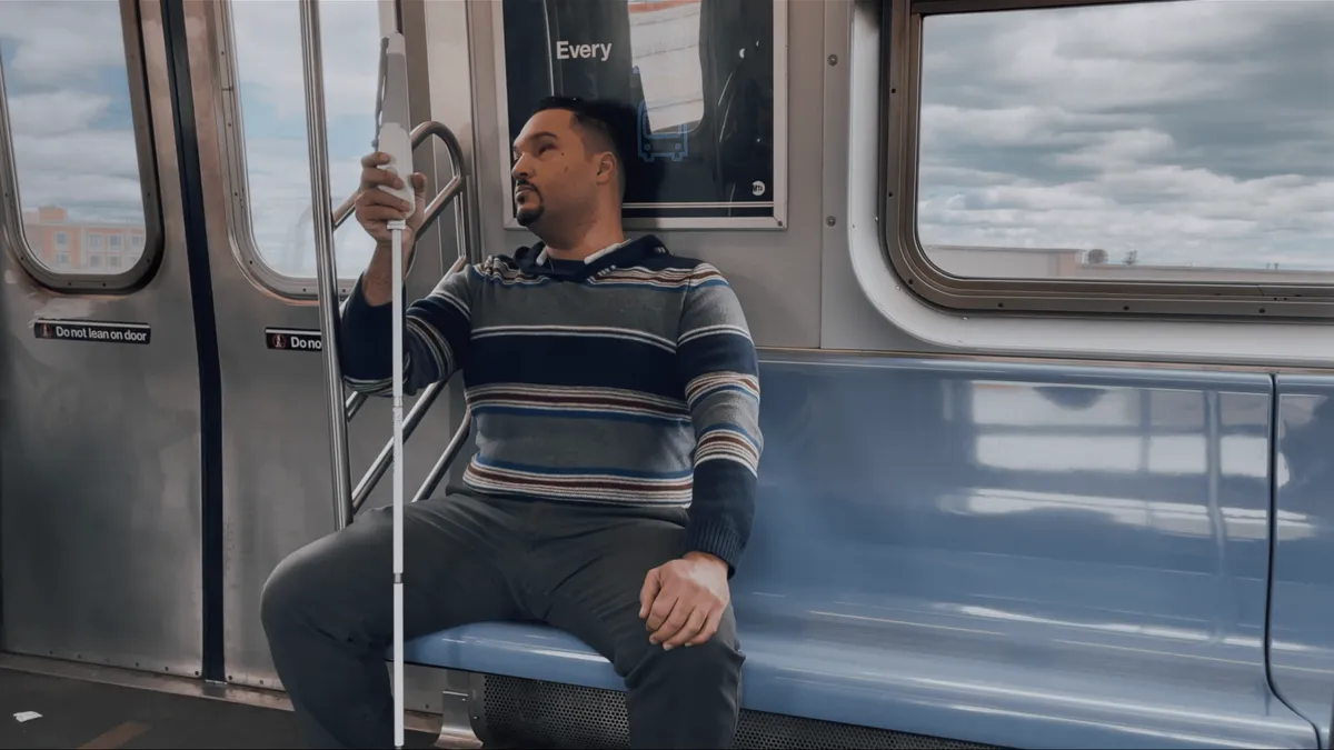
- Transit data firm Moovit and UK startup WeWALK have partnered on technology that will offer transit navigation and scheduling information to visually impaired riders through WeWALK’s electronic cane.
- WeWALK’s smart cane has sensors that can alert users to obstacles above the ground with a vibrating handle. WeWALK also has a Bluetooth-connected app, which now includes Moovit’s Transit API to provide navigation to transit stops, real-time information on schedules and live directions.
- "We want to ensure that people with disabilities feel confident and have the information to not be disadvantaged in any way in using transit," said Luke Redfern, Moovit’s partnerships manager. "This will provide the same level of information that would be available to all riders and we hope users will see that transit is accessible in many different ways."
Dive Insight:
Transportation and mobility can be a particular challenge for the roughly more than 253 million visually impaired people worldwide.
According to a 2020 report from the American Foundation for the Blind (AFB), without driving, "remaining self-sufficient requires navigating a complex patchwork of public and private transportation systems." The report found that some visually impaired people have difficulty maintaining employment and getting to medical appointments because of transportation challenges. A 2019 survey of visually impaired people found that 79% of respondents said transportation challenges had a negative impact on employment.
In an email, Sarah Malaier, senior advisor for public policy and research at AFB, said people who are blind or have low vision face a "wide variety of barriers" and that "although most public transit vehicles are designed for accessibility, there are always exceptions and times when maintenance or unexpected issues arise." This has been especially pronounced, she said, during the pandemic, when some bus riders were required to stay away from drivers, making it hard to hear verbal stop announcements or schedules were changed.
However, she added, "Many blind and low vision people do navigate completely independently when the infrastructure is accessible and well maintained. The role of accessible technologies is to help fill these gaps in accessibility and improve comfort and convenience on otherwise accessible trips."
While public transit agencies have often struggled to make their services accessible to people with disabilities, some cities have worked to adopt technology that helps visually impaired riders. A partnership between the Massachusetts Bay Transportation Authority and the Perkins School for the Blind produced the app BlindWays, which uses GPS and transit data to give specific directions to users in the Boston area, down to physical landmarks like poles and benches. BlindSquare, "the world’s most widely used accessible GPS-app," also incorporates public transportation information.
Intel-backed Mobility as a Service company Moovit has real-time transit and direction data for more than 3,400 cities across 112 countries. Their partnership with WeWALK will integrate that data into technology-enhanced white canes for tactile or verbal directions. The cane can announce route options and offer step-by-step directions, including details about where a user should stand to board and even offering information on how crowded certain vehicles are as they arrive.
Redfern said the directions will be especially helpful to riders going on new routes, which are often major barriers to visually impaired people.
“We believe that mobility is a basic human right and should be accessible to everybody,” Redferrn said. “If you use a WeWALK cane or sensor, you can now take transit across all of the cities and countries where we operate. This is part of our effort to make sure we don’t leave anyone behind.”
Roberto Manduchi, a University of California, Santa Cruz computer science and engineering professor who has worked on technology to make transit more accessible, said that apps like Google Maps, Transit and Moovit have made navigation easier for everyone, especially people with visual impairments. However, he said, navigating transit hubs with multiple stops, gates or crossings can be "really confusing and potentially dangerous if you have little or no vision" and more advances are needed to make ridership safer.
"Localization is only one part of the equation – and, importantly, any localization system will fail under certain conditions," Manduchi said in an email. "The other two necessary components are maps, with a level of detail that is normally not found in the available maps that are posted online; and an accessible interface that can help you navigate a transit station in the face of possible localization errors."


