Dive Brief:
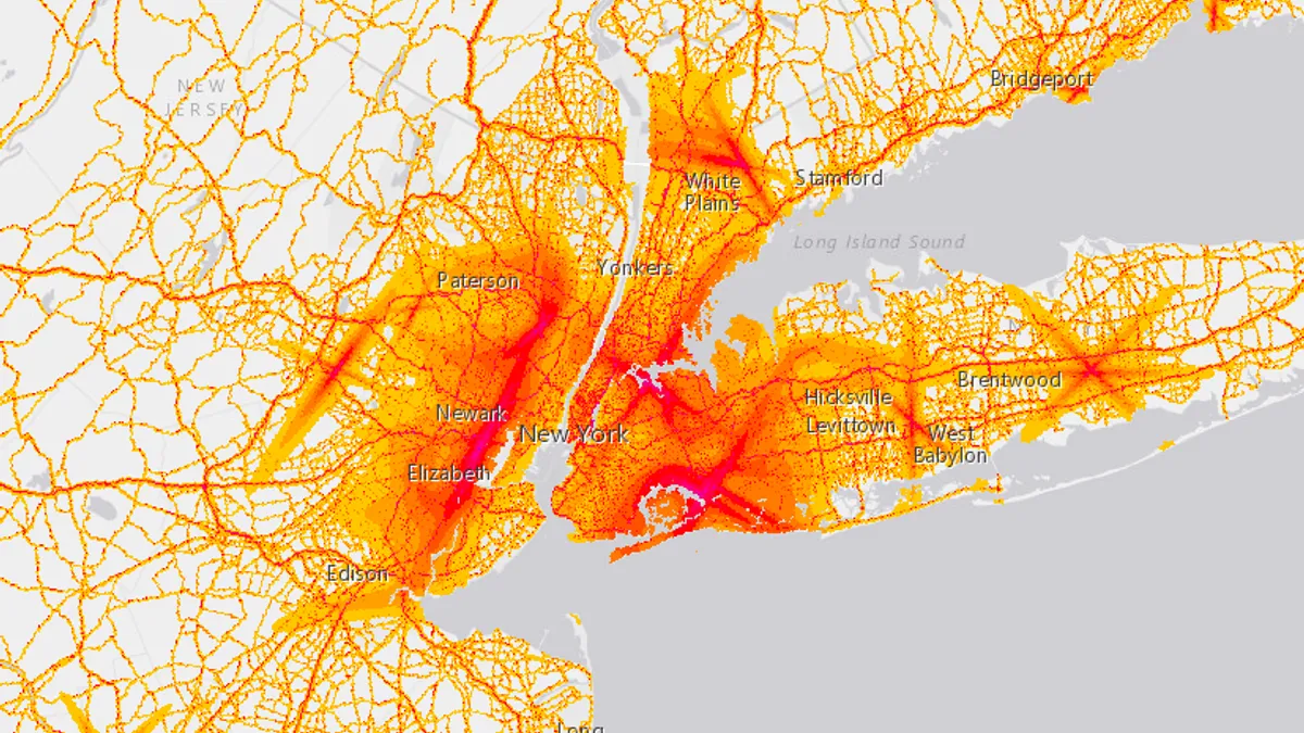
- The Bureau of Transportation Statistics (BTS) released a National Transportation Noise Map to detail areas of noise pollution using data from the Federal Aviation Administration and the Federal Highway Administration. Los Angeles, Dallas, New York and other metropolitan areas were highlighted as the loudest locations.
- Even outside of the hot spots, BTS reported more than 97% of U.S. citizens are exposed to noise from planes and highways at levels below 50 decibels.
- BTS noted that the map will be updated annually, and future versions of the map will likely offer insights on more methods of transportation that contribute to noise levels.
Dive Insight:
Beyond hearing loss, studies have shown that noise exposure can affect everything from obesity to cardiovascular health. Noise problems will likely only get worse if they're not addressed as cities grow, which is happening rapidly. By 2050, the global population is expected to grow to over nine billion, and 80% of that population will reside in cities. Today, cities are home to just over half of the global population of seven billion.
So far, creating noise maps is the furthest most cities have gotten to understanding and addressing the problems surrounding noise pollution. Tools like the NoiseTube app, which uses the GPS systems and microphones in smartphones to gather noise data and create collaborative maps, have made map making easier and in some cases, more detailed.
Last year, New York University launched Sounds of New York City (SONYC), a multi-year research initiative to create noise maps across the Big Apple. The project plans to use data mining and predictive models that city enforcement officials can leverage to more “strategically identify and mitigate noise.” Another notable project to take on noise is by Singapore’s Housing and Development Board (HBD), a government agency that runs extensive public housing. HBD signed a deal last year with 3M to develop material that better insulates apartments from outside noise.


